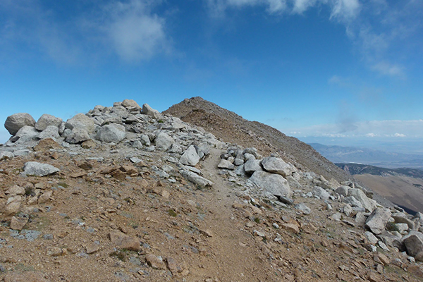
OVERVIEW OF THE U.S. STATE HIGHPOINTS
Welcome to the Bigroads guide to the highpoints of the United States!
There are 50 states in the United States, so naturally there are also 50 state highpoints. One of the things that U.S. travelers, adventurers and road-trippers like to do is to try to visit as many of these highpoints as possible (these folks are called "Highpointers").
In season, you can drive up to, or within a short walking distance of, many of the 50 state highpoints. However, other highpoints require more effort, demanding anything from short walks to backpacking trips to serious multi-day mountaineering endeavors.
Presented below is an overview of the 50 U.S. state highpoints. Take note that some trailhead and summit roads, and actual trails themselves, may be closed and/or dangerous to travel throughout the winter. Also take note that permission from landowners to visit the highpoint is sometimes required if the highpoint is located on private property.
If you are interested in visiting the U.S. state highpoints, we highly recommended that you pick up a copy of either (or both) of these two great guidebooks:
Highpoints of the United States: A Guide to the Fifty State Summits
Highpoint Adventures: The Complete Guide to the 50 State Highpoints

| STATE |
HIGHPOINT |
TOWN / PARK |
ELEV-
ATION |
QUALITY
OF VIEWS |
CLASS
(of the
easiest route) |
ACCESS |
GUIDE
BOOK |
| Alabama |
Cheaha Mountain |
Cheaha
State Park |
2,405 feet |
great |
Class I
terrain |
drive up (year-round) |
book |
| Alaska |
Denali |
Denali
National Park |
20,310 feet |
outstanding |
Class IV
terrain |
mountaineering (extremely difficult) |
book |
| Arizona |
Humphreys Peak |
Coconino
National Forest |
12,633 feet |
outstanding |
Class I
terrain |
most commonly done as a hike (difficult)
but can also be backpacked |
book |
| Arkansas |
Magazine Mountain |
Ozark
National Forest |
2,753 feet |
great |
Class I
terrain |
short hike (easy) |
book |
| California |
Mount Whitney |
Inyo
National Forest |
14,495 feet |
outstanding |
Class I
terrain |
long day hike or backpack (difficult);
permits are required for either option |
book |
| Colorado |
Mount Elbert |
San Isabel
National Forest |
14,433 feet |
outstanding |
Class I
terrain |
hike (very difficult); start early to avoid
common summer thunderstorms |
book |
| Connecticut |
Mount Frissell
-South Slope |
privately owned
(but the public is welcome) |
2,380 feet |
good
(nearby views) |
Class I
terrain |
hike (moderate) |
book |
| Delaware |
Ebright Azimuth |
owned by the town of
Azimuth
|
448 feet |
none |
Class I
terrain |
drive-up (year-round) |
book |
| Florida |
Britton Hill |
owned by the town of
Lakewood |
345 feet |
poor |
Class I
terrain |
drive-up (year-round) |
book |
| Georgia |
Brasstown Bald |
Chattahoochee
National Forest |
4,784 feet |
great |
Class I
terrain |
short walk (easy) |
book |
| Hawaii |
Mauna Kea |
Mauna Kea
Forest Reserve |
13,796 feet |
excellent |
Class I
terrain |
short hike (easy) |
book |
| Idaho |
Borah Peak |
Challis
National Forest |
12,662 feet |
outstanding |
Class IV
terrain |
hike/rock scramble (extremely difficult) |
book |
| Illinois |
Charles Mound |
privately owned
(but the public is welcome) |
1,235 feet |
none |
Class I
terrain |
short hike (easy) |
book |
| Indiana |
Hoosier Hill |
privately owned
(but the public is welcome) |
1,257 feet |
none |
Class I
terrain |
short walk (easy) |
book |
| Iowa |
Hawkeye Point |
privately owned
(but the public is welcome) |
1,670 feet |
poor |
Class I
terrain |
short walk (easy) |
book |
| Kansas |
Mount Sunflower |
privately owned
(but the public is welcome) |
4,039 feet |
poor |
Class I
terrain |
drive-up (year-round) |
book |
| Kentucky |
Black Mountain |
privately owned
(but the public is welcome) |
4,139 feet |
none |
Class I
terrain |
drive-up (in season) |
book |
| Louisiana |
Driskill Mountain |
privately owned
(but the public is welcome) |
535 feet |
none |
Class I
terrain |
short hike (easy) |
book |
| Maine |
Katahdin |
Baxter
State Park |
5,268 feet |
outstanding |
Class II/II+
terrain |
most commonly done as a hike (very
difficult) but can also be backpacked |
book |
| Maryland |
Backbone Mountain |
privately owned
(but the public is welcome) |
3,360 feet |
fair |
Class I
terrain |
hike (moderate) |
book |
| Massachusetts |
Mount Greylock |
Mount Greylock
State Reservation |
3,487 feet |
very good |
Class I
terrain |
most commonly done as a drive-up (in
season) but can be hiked or backpacked |
book |
| Michigan |
Mount Arvon or
Mount Curwood |
privately owned
(but the public is welcome) |
1,979 feet |
none |
Class I
terrain |
short hike (easy); it is likely that Mount Curwood is now the highpoint |
book |
| Minnesota |
Eagle Mountain |
Superior
National Forest |
2,301 feet |
none |
Class I
terrain |
hike (moderate) |
book |
| Mississippi |
Woodall Mountain |
privately owned
(but the public is welcome) |
806 feet |
none |
Class I
terrain |
drive-up (year-round) |
book |
| Missouri |
Taum Sauk
Mountain |
Taum Sauk Mountain
State Park |
1,772 feet |
none |
Class I
terrain |
short walk (easy) or you can hike (difficult) |
book |
| Montana |
Granite Peak |
Custer & Gallatan
National Forests |
12,799 feet |
outstanding |
Class IV
terrain |
hike/rock scramble (extremely difficult) |
book |
| Nebraska |
Panorama Point |
privately owned
(but the public is welcome) |
5,426 feet |
poor |
Class I
terrain |
drive-up (year-round) |
book |
| Nevada |
Boundary Peak |
Inyo
National Forest |
13,140 feet |
outstanding |
Class II
terrain |
hike (difficult); generally regarded as one
of the least enjoyable highpoint hikes |
book |
| New Hampshire |
Mount Washington |
Mount Washington
State Park |
6,288 feet |
outstanding |
Class I/II
terrain |
drive-up + a short walk (in season) or you
can hike or
backpack (very difficult) |
book |
| New Jersey |
High Point |
High Point
State Park |
1,803 feet |
very good |
Class I
terrain |
drive-up (year-round) |
book |
| New Mexico |
Wheeler Peak |
Carson
National Forest |
13,161 feet |
outstanding |
Class I
terrain |
most commonly done as a hike (difficult)
but can also be backpacked |
book |
| New York |
Mount Marcy |
Adirondack
Forest Preserve |
5,344 feet |
outstanding |
Class I
terrain |
most commonly done as a hike (very
difficult) but can also be backpacked |
book |
| North Carolina |
Mount Mitchell |
Pisgah National Forest |
6,684 feet |
outstanding |
Class I
terrain |
drive-up + a short walk (in season) or you
can hike or backpack (very difficult) |
book |
| North Dakota |
White Butte |
privately owned
(but the public is welcome) |
3,506 feet |
great |
Class I
terrain |
hike (easy) |
book |
| Ohio |
Campbell Hill |
privately owned
(but the public is welcome) |
1,549 feet |
none |
Class I
terrain |
drive-up (year-round) |
book |
| Oklahoma |
Black Mesa |
Black Mesa
Nature Preserve |
4,973 feet |
fair |
Class I
terrain |
hike (moderate) |
book |
| Oregon |
Mount Hood |
Mount Hood
National Forest |
11,239 feet |
outstanding |
Class IV
terrain |
mountaineering (extremely difficult) |
book |
| Pennsylvania |
Mount Davis |
Forbes
State Forest |
3,213 feet |
none |
Class I
terrain |
drive-up (year-round) |
book |
| Rhode Island |
Jerimoth Hill |
privately owned
(but the public is welcome) |
812 feet |
none |
Class I
terrain |
drive-up (year-round) |
book |
| South Carolina |
Sassafras Mountain |
conservation land
owned by state of SC |
3,554 feet |
none |
Class I
terrain |
drive-up (year-round) |
book |
| South Dakota |
Black Elk Peak |
Black Hills
National Forest |
7,242 feet |
outstanding |
Class I
terrain |
hike (moderate) |
book |
| Tennessee |
Clingmans Dome |
Great Smoky Mountains
National Park |
6,643 feet |
outstanding |
Class I
terrain |
short uphill walk on paved trail (moderate) |
book |
| Texas |
Guadalupe Peak |
Guadalupe Mountains
National Park |
8,749 feet |
outstanding |
Class I
terrain |
day hike (very difficult) |
book |
| Utah |
Kings Peak |
Ashely & Wasatch
National Forests |
13,528 feet |
outstanding |
Class II
terrain |
backpacking (very difficult) |
book |
| Vermont |
Mount Mansfield |
Mount Mansfield
State Forest |
4,393 feet |
outstanding |
Class I/II
terrain |
drive-up+short hike (moderate) or you can
hike/backpack (difficult) |
book |
| Virginia |
Mount Rogers |
Jefferson
National Forest |
5,729 feet |
great |
Class I
terrain |
hike (difficult) |
book |
| Washington |
Mount Rainier |
Mount Rainier
National Park |
14,410 feet |
outstanding |
Class IV
terrain |
mountaineering (extremely difficult) |
book |
| West Virginia |
Spruce Knob |
Monongahela
National Forest |
4,861 feet |
great |
Class I
terrain |
drive-up (in season) or hike (very difficult) |
book |
| Wisconsin |
Timms Hill |
Timm's Hill
County Park |
1,951 feet |
great |
Class I
terrain |
short walk (easy) |
book |
| Wyoming |
Gannett Peak |
Bridger National Forest &
Shoshone National Forest |
13,804 feet |
outstanding |
Class IV
terrain |
mountaineering (extremely difficult) |
book |
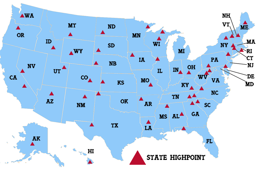
U.S. STATE HIGHPOINTS MAP
HELPFUL HIGHPOINTING WEB LINKS
Official site of the Highpointers: > link
Detailed trip reports on most U.S. state highpoints: > link
IDEAS FOR HIKING THE HIGHPOINTS
Do all the highpoints based on when each state became part of the United States.
Do all the highpoints in alphabetical order based on state name.
Do all the highpoints based on elevation (lowest to highest probably makes the most sense).
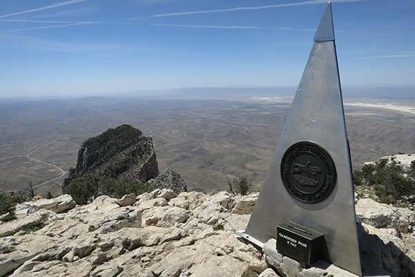
obelisk atop Guadalupe Peak, Texas
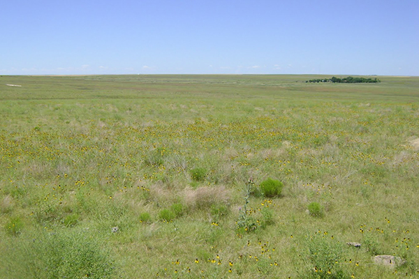
view from Mount Sunflower, Kansas
(picture courtesy of Patricia Herr)
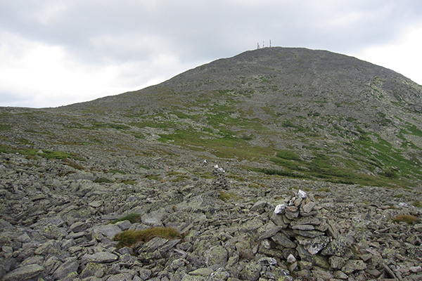
views on the way up Mt. Washington, New Hampshire
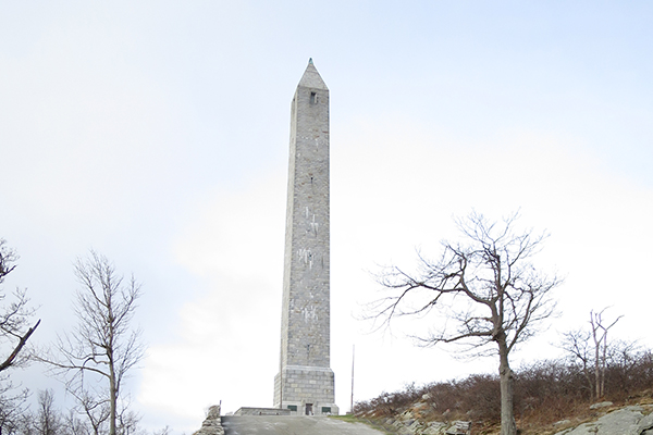
monument at the top of High Point State Park, New Jersey
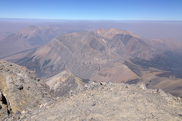
views from the summit of Borah Peak, Idaho
(picture courtesy of Patricia Herr)
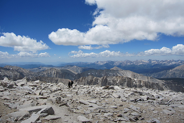
views from the summit of Mt. Whitney, California
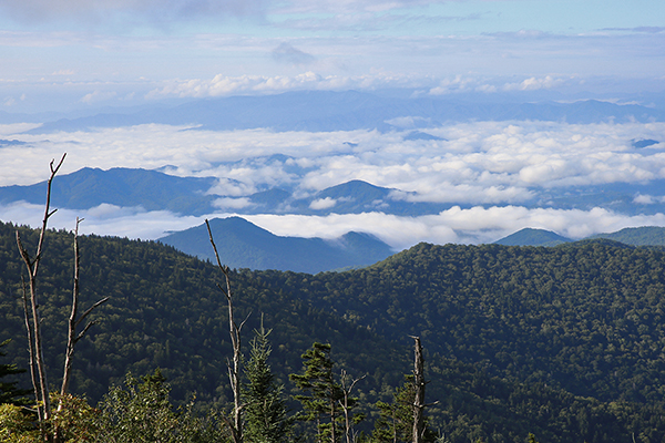
view from the lookout tower atop Clingmans Dome, Tennessee
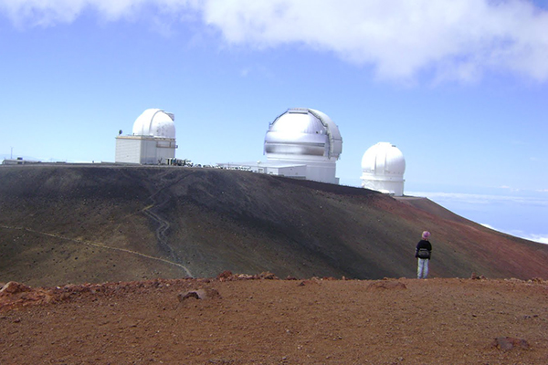
observatory atop Mauna Kea, Hawaii
(picture courtesy of Patricia Herr)
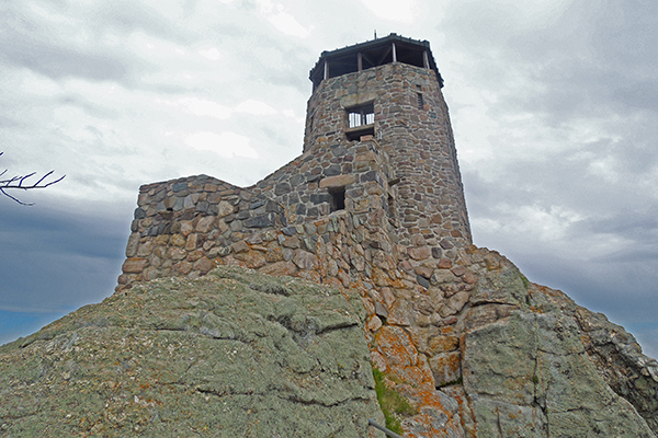
stone tower atop Black Elk Peak (formerly Harney Peak), South Dakota
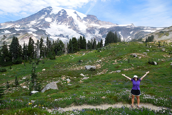
view of Mount Rainier from the Skyline Loop, Washington
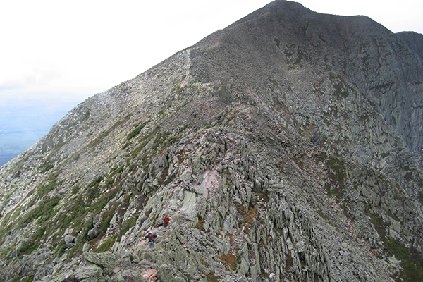
Knife Edge Trail en route to Katahdin, Maine
As an Amazon Associates affiliate, this website contains affiliate links. If you choose to purchase any products after clicking any Amazon.com link, I may receive a commission at no extra cost to you. I only endorse products that I have personally used or those that come highly recommended by trusted peers.
|


