HIKING KATAHDIN IN BAXTER STATE PARK
Welcome to the Bigroads guide to hiking Katahdin (5,268') in Baxter State Park of Maine!
Katahdin is arguably the most beautiful mountain in the East, and serious hikers consistently select it as their most memorable hike in the Northeast. Most people come to hike the famed Knife Edge Trail, but all trails that climb this mountain are breathtaking. Katahdin's trails are all rated as strenuous or very strenuous, so successfully hiking this mountain truly is no small feat.
If you are looking for additional things to do while in this area, check out our Top 25 Attractions of Millinocket & Katahdin Region page.
HIKING TRAILS ON KATAHDIN
Katahdin (aka Baxter Peak) has three trailheads that provide day hiking access to the mountain: Hunt, Abol and Roaring Brook. All three trailheads require that you obtain a parking permit from the Baxter State Park Authority. Parking permits can now be purchased online from the Authority's website days or weeks in advance, although you can get lucky, especially mid-week, by arriving real early at the south entrance of the park and scoring a day-of parking permit.
If you want to hike the Knife Edge Trail, you should try your hardest to obtain a coveted parking permit online well in advance for the Roaring Brook Trailhead.
You can theoretically hike the Knife Edge from the Abol and Hunt trailheads, but the park rangers don't really want you to do this because it means that you have to hike the 1.1-mile Knife Edge twice - once down to Pamola Peak and then all the way back up. In other words, hiking the Knife Edge Trail twice requires near superhuman-level effort.
Assuming you don't have a strong fear of heights and it's not too windy, snowing or raining, the Knife Edge Trail is difficult but doable. There is some steep scrambling required near the eastern terminus of the trail at Pamola Peak, but it's over with very quickly. There are a few other sections that are only 3-5 feet wide, but as long as the weather is decent, walking this trail is more exciting and thrilling than it is scary. We avoid hiking the Knife Edge Trail in inclement weather or when the wind is blowing more than 25-30mph. We encourage you to do the same.
The Abol Trail on Katahdin has been closed for several years due to unstable rock conditions, but a modified version of the trail was reopened in early July 2016 (new trail description: here). If you can't get a Roaring Brook parking permit, a loop using the Abol & Hunt trails from the Abol trailhead is perhaps the next best thing. However, if all you can snag is a parking permit for the Hunt trailhead, don't fret: that's a beautiful trail, too.
The Dudley Trail on Katahdin experienced a significant rockfall in the spring of 2016. The trail is still closed as of 2019. The Baxter State Park Authority has suggested that it will ultimately re-open a trail there, but but they don't have a timeline for completion yet.
MOST POPULAR KATAHDIN TRAILS
Here are the five most popular routes that hikers take up Katahdin.
About 80-90% of the folks who day hike Katahdin will hike the mountain using one of these popular routes. All five of these routes are rated as strenuous/very difficult:
Our absolute favorite way to hike Katahdin is the Dudley/Saddle Loop, which calls for ascending the Dudley Trail (fun scrambling!) and walking up and across the Knife Edge Trail to Katahdin/Baxter Peak. The reason this is our favorite is because we always prefer to climb up the Knife Edge Trail, rather than down it. We also love the photo opportunity provided by scrambling up Pamola's Finger near the top of the Dudley Trail. However, take note that Dudley Trail is closed as of 2019.
MORE ROUTES/TRAILS ON KATAHDIN
In addition to the five most popular routes, there are several other ways to day hike Katahdin. All of these routes are hiked fairly frequently and are normally easy to follow. They are all strenuous/very difficult:
HIKING KATAHDIN & HAMLIN PEAK TOGETHER
Strong/fit hikers may be interested in also summiting nearby Hamlin Peak while hiking Katahdin since Hamlin is a "New England 100 Highest" summit. For those of you who are interested in this tough peak-bagging endeavor, here are your options:
Our absolute favorite way to hike both Katahdin & Hamlin Peak in one day hike is the Dudley/Hamlin Loop, which calls for ascending the Dudley Trail (fun scrambling!) and walking up and across the Knife Edge Trail to Katahdin/Baxter Peak. The reason this is our favorite is because we always prefer to climb up the Knife Edge Trail, rather than down it. We also love the photo opportunity provided by scrambling up Pamola's Finger near the top of the Dudley Trail. This route also avoids the dreaded Saddle Trail.
TAKE NOTE THAT THE DUDLEY TRAIL IS CURRENTLY *CLOSED* AS OF 2019 (DUE TO A ROCKSLIDE IN 2016). IT IS NOT KNOWN IF/WHEN THE TRAIL WILL REOPEN.
HOW DIFFICULT ARE KATAHDIN'S TRAILS?
None of Katahdin's hiking trails are easy. All trails require miles of tough hiking plus rock scrambling to one degree or another. The trail ratings below are based on the 'classes' from the reliable and widely-used Yosemite Decimal System, which is the system most commonly used in the United States to rate rock scrambles and rock climbs.
- Abol Trail: Class II/II+ (steep with loose scree and unstable footing)
- Cathedral Trail: Class II+/III (the steepest trail on the mountain; some may find this trail unnerving)
- Dudley Trail: Class II+ (some of the most fun scrambling in the East; don't miss Pamola's Finger); take note that this trail is *closed* as of 2019
- Hunt Trail: Class II/II+ (some metal rungs assist you while you climb; enjoy the false summit)
- Knife Edge Trail: Class III (only one section near Pamola Peak is class III; the rest of the trail is II/II+)
- Saddle Trail: Class II/II+ (steep with loose scree and unstable footing)
Here are the rock scrambling class definitions from the Yosemite system:
- Class I: Easy walking/hiking with a very low chance of injury; no use of hands required; a fall is highly unlikely to be fatal.
- Class II: Simple scrambling with occasional use of the hands; a fall is unlikely, but injury could result; a fatal fall is unlikely.
- Class III: Significant scrambling with moderate to heavy use of the hands; a rope is not necessary; falls can cause injury but are not usually fatal.
- Class IV: Intense scrambling; a rope is sometimes used; helmet recommended in case of fall or rock fall.

KATAHDIN & BAXTER STATE PARK TRAIL MAPS
The Baxter State Park Authority has created some good hiking maps and they are available for free on their website. The maps show elevation/contour lines, but unfortunately they don't list the distances of each trail section like the maps contained with the AMC Maine Mountain Guide do.
Here are links to the maps created by the Baxter State Park Authority:
MAP: Roaring Brook / Chimney Pond Trail / Knife Edge trailhead: link
MAP: Hunt / Hunt Trail / Appalachian Trail trailhead: link
MAP: Abol / Abol Trail trailhead: link
TIPS FOR HIKING KATAHDIN
There's a lot you need to know before you set out to drive to Baxter State Park and hike the most scenic and alluring mountain in the East. Take a read...
- PARKING PERMITS - Except for Appalachian Trail thru-hikers, day hiking Katahdin from its three trailheads (Roaring Brook, Abol and Hunt) require a parking permit. Parking permits are limited, especially for the Roaring Brook trailhead, which is what hikers use to hike the famed Knife Edge Trail.
- Information on how to obtain a Day Use Parking Reservation ('DUPR') parking permit can be found on the Baxter State Park Authority website.
- Long gone are the days where you absolutely had to wake up at 3:00am in the morning to get in line at the Togue Pond Gate so that you could be one of the first 30 or 40 cars to be allowed into the park to hike Katahdin from the Roaring Brook trailhead. You can now at least try to get a permit online ahead of time-although this requires that you still enter the park by a certain time (7:00am, currently) or you will forfeit your permit. If you are trying to obtain day-of entry without an advance permit (because you either failed to reserve online or the website was sold out of permits), you may still want to get in line super early for the best chance of getting in.
- Maine residents get first chance to grab DUPR parking permits, typically in April of each year. Non-residents can currently reserve parking permits online up to two (2) weeks before the intended date of their hike.
- You can still often score a day-of parking permit for the Katahdin trailheads by arriving at the Togue Pond Gate early and hoping that either (1) the parking permits for your intended Katahdin trailhead were not previously sold out online (b) the park is holding extra permits specially for day-of guests or (c) that somebody forfeited their DUPR parking permit by not showing up by the parks' specified cutoff time.
- Persons staying at campgrounds inside the state park do not need to obtain a daily parking permit. However, campers are encouraged to let their campground ranger know of their hiking plans the day/night before their hike.
- BRING CASH - Baxter State Park does not accept credit or debit cards, so remember to bring cash with you to cover the per-vehicle entrance fees (free access for Maine residents) and also camping fees.
- HIKING SEASON - The normal hiking season for Katahdin is late-May/early-June through the first significant snowfall of October or October 15th, whichever is earlier. The black flies that thrive here are brutal, and so we urge you to either bring a bug net or consider avoiding this park until the black fly season ends around mid-July. Fall foliage is, as you might expect, gorgeous, but the higher reaches of the mountain will likely be very cold.
- SOUTHERN ENTRANCE - Nearly all day hikers of Katahdin will enter Baxter State Park from the south via the town of Millinocket and the Togue Pond Gate. The Togue Pond Gate is about 17.5 miles and 30 driving minutes from the town of Millinocket. It is simply too far to reach the Katahdin trailheads from the northern entrance since the roads of Baxter State Park are very long and are marked as 20 mph.
- Millinocket is a very basic lumber industry-type town, so don't expect too much in terms of gourmet food or luxurious accommodations (except for perhaps the services provided by the whitewater rafting outfitters in town). Basic services and simple accommodations (like cabins) are pretty much the name of the game here. There are a few great restaurants in town (The River Driver's and Appalachian Trail Cafe come to mind).
- STORMS/BAD WEATHER - Katahdin is notorious for its stormy weather. Many people have died or have been seriously injured here. Avoid this mountain when severe weather is threatening. If you find snow or ice present on the trails and you don't have the necessary gear (i.e. foot traction), we suggest just turning around and hiking Katahdin another time.
- TRAILS TO AVOID WHEN DESCENDING - The Cathedral, Abol and Dudley trails on Katahdin are not recommended for descent. These are the most consistently intense and steep hiking routes on the mountain, and all of them involve significant rock scrambling or loose scree slopes.
- However, hikers do descend the Abol and Dudley trails quite frequently without incident, so it is not impossible to hike down these routes.
- Descending the Cathedral Trail is outright dangerous and should only be performed as an absolute last resort.
- SADDLE TRAIL - The Saddle Trail is perhaps the least enjoyable trail on the mountain - it is a steep scree slope, with loose/unsure footing. At this point in our hiking careers, we have pretty much decided that we really dislike this trail. We typically add Hamlin Peak to our hike so that we can avoid the Saddle Trail but still do a big loop of Katahdin.
- KATAHDIN IN WINTER - You can hike Katahdin in winter, but you need solid winter/mountaineering experience and permission from the park. Many winter hikers will cross-country ski into and stay at the heated bunkhouse at Chimney Pond. The bunkhouse can then be used as a basecamp to climb Katahdin, most commonly with crampons and an ice ax via the Saddle Trail.
- APPALACHIAN TRAIL HIKERS - If you hike Katahdin between August 15th and October 15th, you stand a fair chance of seeing some hikers finish their journey of the 2,180-mile Appalachian Trail. This is a huge moment for them in their lives, and it's quite an experience to watch these celebrations.
- CUT-OFF ENTRY TIME - You have to enter the state park by a certain time in the early morning hours or you'll forfeit your parking permit. In the past, the cutoff time was 7:00am, but you should always check the Baxter State Park Authority website for the most current cutoff time. You also have to actually start hiking up Katahdin before the strict cutoff times that are set by the park rangers.
- ASCEND OR DESCEND THE KNIFE EDGE - We find it much more enjoyable to ascend the Knife Edge Trail than to descend it. It is simply easier to scramble up this trail than down it in our opinion. Also, the steepest part of the Knife Edge Trail is the chimney just below Pamola Peak. If you can get through this section, the rest of the Knife Edge can be pure hiking bliss since you know that the most challenging / potentially scary section is already over.
- KNIFE EDGE TRAIL - Most hikers will only hike the Knife Edge Trail once per trip; in other words, they will take another route up or down the mountain to make a loop (or a "lollipop" type of loop).
- BLAZING - All trails on Katahdin are marked with blue blazes, except for the Hunt Trail, which is white-blazed like the rest of the Appalachian Trail.
- OTHER TRAILS - The Knife Edge Trail isn't the only worthwhile way to hike Katahdin - there are other trails that are nearly as fun and scenic. The Hunt Trail is one excellent alternative.
- SLOW HIKING - Even strong hikers will only average 1.0-1.25 miles hiked per hour on Katahdin's extremely rocky and tough trails. Don't expect any quick miles on this mountain, and always carry a headlamp (or two) in case it gets dark sooner than you expected.
- CELL PHONES - Your cell phone probably won't work on Katahdin, and it definitely won't work on the park roads. Also - be careful about trying to get into the park by using GPS. GPS doesn't always direct you to the park entrance; instead, it often tries to send you to the administrative offices of Baxter State Park, which are in Millinocket. It is recommended that you print a map before leaving and use that map to get to the Togue Pond Gate. There are some signs pointing towards Baxter State Park as you leave Millinocket, but it fairly easy to miss spotting them.
- HAMLIN PEAK - Peakbaggers will often combine hiking Hamlin Peak and Katahdin/Baxter Peak into one tough day hiking loop. This makes for a tough day, but the scenery is fantastic and you have an opportunity to avoid having to take the less-than-optimal Saddle Trail.
- CATHEDRAL TRAIL - The steepest trail on Katahdin is the Cathedral Trail. If you hike this trail, we hope you are comfortable with exposure and we also pray that the ledges aren't wet or icy for you. Oh, and don't even think about descending this trail-doing so is generally regarded as too risky.
- DIFFICULTY - Generally speaking, and depending upon the routes you select, Katahdin is perhaps 10-25% more difficult than hiking Mount Washington in New Hampshire. There are no easy routes to the summit of Katahdin/Baxter Peak - all trails are tough, rocky and long.
- TRAIL JUNCTIONS - All trails and trail junctions are extremely well-marked on Katahdin. As long as the peak is not shrouded in fog, the risk of getting lost is truly minimal. When fog is present, there are a fair number of cairns above treeline to help you navigate. Katahdin in a winter white-out probably wouldn't be fun, but luckily for us snow generally doesn't start hitting the mountain until early to mid-October in most years.
- 10 ESSENTIALS - As a reminder, you should always carry the "10 Essentials" when hiking Katahdin, which includes bringing a high-quality whistle and at least one headlamp.
- DRINK FLUIDS - We typically drink a full 4 liters of water + 1 liter of Gatorade whenever we hike Katahdin. This tough mountain really tends to drain you, so bring more than you think you'll need.
- ROCK SCRAMBLING - If you enjoyed rock scrambling on Katahdin, there are many more mountains in New England that offer rock scrambling. In fact, there are several other mountains throughout New England that have scarier rock scrambles than Katahdin.
- OTHER DAY HIKES - There are many other excellent day hikes in Baxter State Park besides Katahdin. In other words, try to stay in the park or in the greater Millinocket area and hike more than just Katahdin.
- ELEVATION GAIN - All routes that climb Katahdin gain a total of at least 3,900-4,000 feet of elevation gain. If you also climb nearby Hamlin Peak, you can add a few hundred additional more feet to that amount.
- ABOVE TREELINE - All of the routes that climb Katahdin are well above treeline and are 100% exposed to the weather/elements. All trails also include some degree of rock scrambling-if you are moderately afraid of heights (or worse), this is simply not the mountain for you.
- ACCOMMODATIONS - In addition to the campgrounds inside the state park, there are several campgrounds, cabin rentals and hotels in the greater Millinocket area. We haven't found one outside of the park that we are absolutely in love with yet. Our favorite campground outside of the park at the current moment is probably the Katahdin Shadows Campground. We like their cabins and their "jungle" tenting area. However, this campground is about 45 minutes from the south entrance of the park.
- UNPAVED ROADS - All of Baxter's roads are unpaved, but a 2WD vehicle is normally just fine. We can't remember ever seeing a car that was not able to drive Baxter's park roads. Motorcycles, dirt bikes, ATVs, etc. and are not permitted. You can bicycle the park roads.
- WHITEWATER RAFTING - Since you probably have to drive many hours to get the Millinocket/Baxter State Park area, you might as well also take a whitewater rafting trip on the most intense commercially-guided river in New England: the Penobscot River. Northern Outdoors and NEOC are two well-established guiding companies that offer rafting trips + lodging and other services. We've rafted the Penobscot River ourselves, and it's a wonderful experience.

MORE GREAT DAY HIKES IN BAXTER STATE PARK
There are many other great day hikes to be found in Baxter State Park, including the following:
- WATERFALLS
- Little Abol Falls - 0.8 mile (each-way) from Abol Campground to a modest waterfall
- Big & Little Niagara Falls - 1.2 mile (each-way) hike from Daicey Pond to several series of waterfalls
- South Branch Falls - 0.5 mile (each-way) to a small waterfall
- Howe Brook Falls - 3.0 miles (each-way) to a lovely waterfall
- Katahdin Stream Falls - 1.1 miles (each-way) to beautiful, multi-tiered falls
- LAKES/PONDS
- Katahdin Lake
- Chimney Pond
- Daicey Pond
- Five Ponds Trail
- MOUNTAINS/PEAKS
- The Owl
- Mount Oji
- Burnt Mountain
- Traveler Mountain Loop
- Mt. Coe/South Brother Loop
- Doubletop Traverse
- North Brother
- South Turner Mountain
Except for the three Katahdin day-use trailheads, advance parking permits are not needed for all of the other parking areas in Baxter State Park; instead, all these other parking areas are filled daily on a first-come, first-served basis. You'd be wise to get to the park in the early morning hours if you want to guarantee yourself a spot at these trailheads, especially on holidays and weekends.
In addition to the hikes within the boundaries of Baxter State Park, the other hike you absolutely do not want to miss in the area is Gulf Hagas. On a 8.6 mile loop, you'll pass a 1/2 dozen waterfalls and several fun swimming holes. It's often referred to as the 'Grand Canyon of Maine'. Bring a fair amount of cash with you since Gulf Hagas resides on private timberland and there is a steep access fee for out-of-staters. There are some very nice campgrounds you can reserve near Gulf Hagas, but they aren't really practical to use for Katahdin because there is an access gate that is closed each night and it does not open until at least 6:00 in the morning.
For information on more hiking in Baxter State Park, we recommend the 2017 Falcon guide: Hiking Maine's Baxter State Park:

BACKPACKING IN BAXTER STATE PARK
- Some of the finest backpacking on the East Coast can be found in Baxter State Park. It takes a lot of planning (and a bit of luck) to score the permits needed to backpack where and when you want in the park. You can hike to remote summits, visit seldom-seen waterfalls, and you'll spot moose with relative ease.
- Backpacking in Baxter State Park is a mix of tent-sites and lean-tos. There are dozens of exclusive-use lean-tos you can reserve for yourself or your group. There aren't many places where you can rent lean-tos exclusively for backpacking, so this is a real treat.
- Chimney Pond is the only backpacking site from which you can easily reach Katahdin, but luckily it's a beautiful spot.
- As of 2016, there were 9 lean-tos and a 10-person bunkhouse here, all requiring advance reservations.
- Chimney Pond is filled to capacity just about every day of the week from June through the park's closing date in October. Learn to master the reservations process if you want a fair shot at getting a reservation.
- Take note that hiking Katahdin is still quite difficult from Chimney Pond.
- One of the most sought-after backpacking locations in the park is Russell Pond. From here, you can canoe in the pond (the park rents canoes) or you can do day hikes to waterfalls (including gorgeous Green Falls) and to other attractions.
- You can also reach Katahdin by backpacking a multi-day loop from Russell Pond. You may also be able to do a day hike from Russell Pond to tackle Katahdin - I would call the park to inquire whether they allow this or not since it would be a tough and long loop.
- Visit the website of the Baxter State Park Authority to see a list of all the available backpacking options (there are literally dozens of great opportunities).

RECOMMENDED HIKING GUIDEBOOKS
There are several published guidebooks that provide driving directions & trail information for hiking Katahdin & Baxter State Park. Here are some of the best books out there:
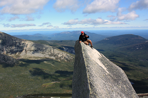
top of Pamola's Finger, Dudley Trail, Pamola Peak
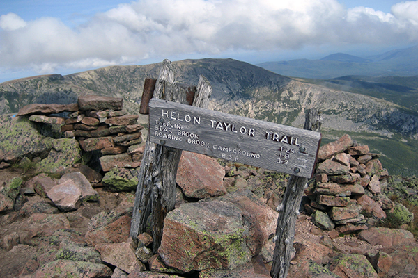
views from the summit of Pamola Peak
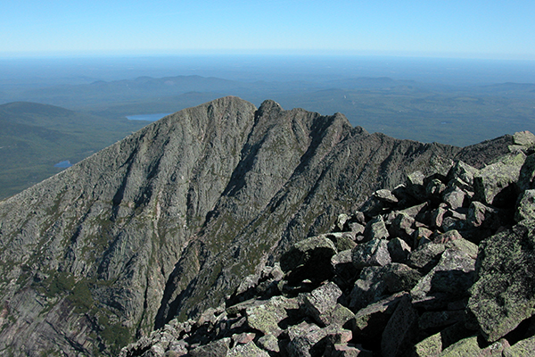
view of the Knife Edge & Pamola Peak from Katahdin/Baxter Peak
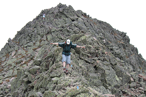
walking the Knife Edge Trail
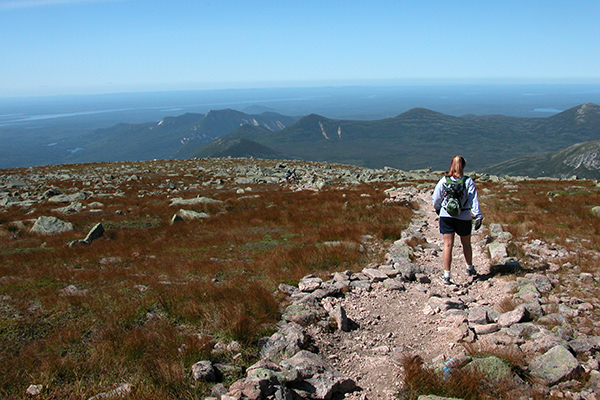
view from the Saddle Trail after coming down from the summit of Katahdin/Baxter Peak
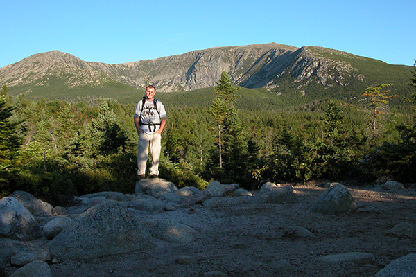
one of several views from the Chimney Pond Trail
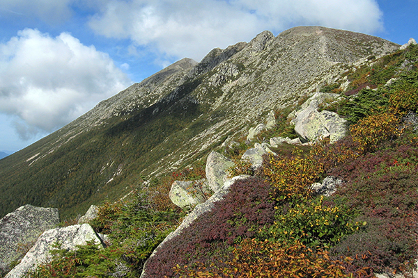
views from the Helon Taylor Trail on the way up Pamola Peak
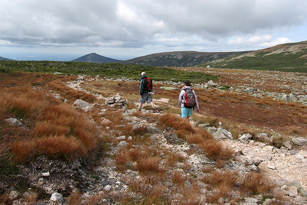
views from the Saddle Trail after coming down from Baxter Peak
As an Amazon Associates affiliate, this website contains affiliate links. If you choose to purchase any products after clicking any Amazon.com link, I may receive a commission at no extra cost to you. I only endorse products that I have personally used or those that come highly recommended by trusted peers.
|


